
Jonesboro Neighbors Record Sources
Public sources describe a block in layers. The Jonesboro and Craighead County GIS shows where parcels touch. DataScout adds the assessed owner and the separate tax mailing address. Recorder plats identify the subdivision, block, and lot. A lawful voter file may add limited election geography, while old directories can show a dated listed occupant. Each source has a different population and date. Treating them as one current list would erase those limits.
| Source | Block Detail Shown | How to Access It |
|---|---|---|
| Jonesboro/Craighead GIS | Parcel shapes, adjacent land, streets, aerials, city limits | Public GIS page or staff data request |
| Assessor/DataScout | Owner, situs, mailing address, parcel, legal description | Online roll or assessor counter |
| Recorder plats | Subdivision, block, lot, and recorded geometry | Circuit Clerk index and books |
| Voter file | Releasable registered-voter geography | Secretary of State request, with restrictions |
| Code and cleanup files | Address-level case or public activity | City form, contact, or FOIA request |
| Historical directories | Dated listed occupants by house number | Library, GSCCA, or institutional microfilm |
The assessor row is an ownership clue, not a census of your neighbors. A situs address locates the land. The mailing address routes tax mail and may point elsewhere. Neither field names renters, relatives, or every person at the premises.
Map Jonesboro Neighbors by Parcel
The immediate-block method begins with one parcel and moves only as far as the question needs. The city GIS page lists parcels, street centerlines, aerial photography, the city-limit boundary, and the Master Street Plan. Its public description does not promise a radius or buffer button, so direct map browsing is the defensible method. Large or raw data requests can go to city GIS staff.
- Find the target address in the Jonesboro/Craighead GIS or pan to its known location. Turn on parcel, street, aerial, and city-limit layers.
- Click the target polygon and copy its parcel ID. Then click each touching parcel and the lots directly across the street.
- Carry every parcel ID into DataScout. Record owner, situs, tax mailing address, legal description, and the roll's date.
- Use a recorded plat when lot lines or street labels are unclear. Keep subdivision, block, and lot text with the parcel.
- Stop at a clear geographic edge. A whole-street project belongs in the Jonesboro by-street records method.
The flow is simple: address to parcel shape, parcel ID to assessor card, legal description to plat, then dated public records for context. It does not jump from an owner name to an unsupported claim about a household.
Jonesboro Block Layers Explained
A parcel boundary answers which tax lot lies beside another. The street centerline helps keep both sides of the road in view. Aerial photography shows the physical setting, not a legal right or resident. The city-limit layer answers whether a parcel is inside Jonesboro government boundaries. These are separate questions, and one layer cannot stand in for the others.
- Parcel
- A mapped unit used for assessment and land records; it may contain no occupied structure.
- Situs address
- The address assigned to the physical parcel, distinct from the owner's tax mailing address.
- Plat
- A recorded drawing that lays out lots, blocks, streets, and easements in a subdivision.
- Legal description
- The lot, block, subdivision, acreage, or metes-and-bounds text that identifies land in a deed.
When a road name or number changes, the legal description often keeps the chain intact. Parcel IDs can also split or change, so compare the recorded land text and plat rather than trusting one current web label.
Jonesboro Neighbor Geography Splits
A Jonesboro mailing city does not settle city jurisdiction. DataScout's millage table distinguishes rural and Jonesboro variants of several school district codes, including Valley View, Brookland, and Nettleton. Two nearby parcels may share a postal label yet fall on different sides of a city, school, or tax line. The city-limit layer and tax district, not the ZIP name, answer that question.
Nettleton is a strong local example. It appears in historic Jonesboro/Nettleton telephone-directory titles, a current city cemetery, and school-district identity. An old Nettleton address may now appear under Jonesboro. Preserve both place names when checking directory or obituary material. Geography changed, while the older printed label remained a valid dated clue.
For election districts, Craighead County's address map accepts a full address and lets a user click the map if geocoding fails. Its district result should not be read as a ZIP, school, or tax boundary.
Jonesboro Neighbors and Voter Files
VoterView is an individual self-check. It asks for first name, last name, date of birth, and county, then returns registration and election context for a match. It is not an open neighbor browser and should not be scraped. A no-match does not prove that a person is absent from the block.
| Election Route | Purpose | What It Does Not Show |
|---|---|---|
| VoterView | One registrant checks status, districts, polling site, and ballot | A browsable street or block list |
| SOS data request | Requests one of the statewide voter-data products under current terms | Protected addresses, restricted identifiers, or ballot choices |
| County Clerk | Local registration procedure and existing releasable records | A custom directory the office does not already keep |
A released file covers registered eligible voters only. It excludes children, noncitizens, unregistered adults, and people whose protected addresses are withheld. Election participation history records attendance, never a ballot choice. Arkansas also does not create a permanent party-registration field in the same way as closed-registration states.
Jonesboro Community Contact Layer
Jonesboro city pages do not publish a central neighborhood-association directory, and private HOA member rosters are not presumed public. That gap matters. Public-facing contacts can still be found through planning hearings, community cleanups, entity filings, library collections, and voluntary civic or congregation directories, but each identifies only the people or groups that chose a public role.
| Local Route | Useful Public Contact |
|---|---|
| City Planning and Zoning | Posted applications and hearing records tied to a project address |
| Code Enforcement | Community cleanup activity and releasable address-based case files |
| Arkansas entity search | Public HOA or association agent and filing address when an entity exists |
| Craighead County Jonesboro Public Library | Local history, newspapers, directories, and organization files |
| GSCCA and local archives | Historical organizations, obituaries, marriages, and cemetery references |
Contact an association through its published office or agent. Do not treat an entity address as a member list, and do not infer that a registered agent lives at the filing address.
Jonesboro Block Activity Records
Jonesboro Code Enforcement began in 2012. Its files can be keyed by complaint address and may cover weeds, trash, dumping, unsafe conditions, inoperative vehicles, boarding, securing, or condemnation. The city form center handles reports, and releasable existing files may be requested by exact address and date range. A case chronology is evidence about the site. A complainant, owner, applicant, or contractor name does not necessarily identify an occupant.
Planning and Inspections add project records. A permit can name an applicant or contractor and date work at a nearby lot. The city publishes workflow and contact routes but no confirmed public historical permit index, so ask Planning or Inspections for the address, approximate range, application, permit, inspection history, and final disposition. Arkansas FOIA can reach existing nonexempt records, but it does not force staff to create a neighbor list.
Use those files for civic and property context. Label dates, roles, and final outcomes. An old complaint should never be presented as a current condition.
Official Jonesboro Neighbor Records
Official rolls and commercial compilations solve different problems. County and city records have a named custodian, a defined field, and a retrieval date. Compilations blend feeds and may merge people or keep obsolete addresses. The latter can be a lead, but it cannot outrank the office that created a parcel, plat, voter, or code record.
| Feature | Official Block Records | Commercial Compilations |
|---|---|---|
| Authority | Named city, county, or state custodian | Mixed private data sources |
| Meaning | Defined role such as owner, registrant, or applicant | Inferred identity or address link may be unclear |
| Correction | Route to the office that keeps the record | Provider-specific removal or correction process |
| Block limits | Omits private households and protected fields by design | May show stale or merged claims |
Return to GIS for parcel shape, DataScout for assessed ownership, and the recorder for title instruments. That source discipline keeps a block project factual.
Custody Lists Are Not Neighbors
The Arkansas Division of Correction inmate search is a statewide custody tool, not a map of Jonesboro neighbors. It searches by ADC number, name, and available demographic filters, and the state also offers a downloadable database. A result can show state custody facts and status. It does not prove where a person lives now, and a county booking or charge is not a conviction.
The official Arkansas inmate search is shown here because its narrow scope must remain clear.
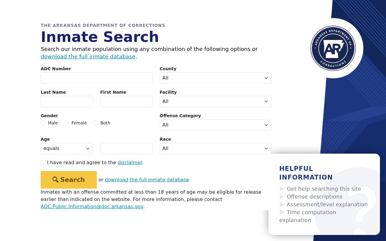
Confirm a public court disposition in the proper court index, keep the retrieval date, and never place a custody result onto a block map as if it were a current address.
Privacy Around Jonesboro Neighbors
Public parcel tools omit renters and household members. Utility, delivery, and motor-vehicle address data are not ordinary public block sources. Arkansas voter products exclude restricted identifiers and protected addresses. The Secretary of State's Address Confidentiality Program gives eligible victims a substitute mailing address, and no search should be used to reverse that protection.
A neighbor search can support property curiosity, local history, or a lawful attempt to reach a public association contact. It cannot justify watching a person, repeated unwanted contact, trespass, threats, or publication of sensitive details. Arkansas stalking, harassment, and threat laws can apply when address data is weaponized.
Lawful use. Use Jonesboro block records with restraint, respect protected addresses, and never stalk, harass, intimidate, trespass, or harm another person.