
Jonesboro ZIP Coverage
The Jonesboro ZIP code directory has two standard delivery areas and two special-purpose codes confirmed by the research. The descriptions below are broad postal patterns, not official boundary polygons. USPS does not publish neighborhood prose or a local polygon map through its address lookup. Verify an individual address instead of treating the table as a line-by-line boundary source.
| ZIP | Areas covered | Post office | Postal note |
|---|---|---|---|
| 72401 | Central, east, and north-central Jonesboro, including downtown and the older core | Jonesboro postal facilities | Standard delivery; the Jonesboro mailing area can extend beyond strict city-line contexts |
| 72404 | South and southwest Jonesboro growth areas | Jonesboro postal facilities | Standard delivery, with many newer subdivisions and commercial corridors |
| 72403 | Jonesboro post office boxes | Jonesboro | PO-box code, not a street-neighborhood boundary |
| 72402 | Unique or organization-associated Jonesboro mail | Jonesboro | Do not treat it as a residential district without USPS confirmation |
The distinction changes the search. A standard delivery code may narrow current mail, but it still includes many streets and does not identify an occupant. The two special codes describe mail handling rather than a resident area. No official split or realignment year was found, so none should be inferred from an old address.
Jonesboro Records in 72401
The 72401 area broadly covers central, eastern, and north-central Jonesboro, including downtown and the older core. That description helps choose a first search, but a postal city does not answer whether a parcel falls inside Jonesboro's legal boundary. Check the city-limit layer in the Jonesboro/Craighead County GIS. Then read the parcel card for situs, owner mailing address, millage code, and legal description.
Older address research may need more than the current ZIP. The 1906 city directory, the July 1919 Sanborn map, later microfilm directory years, and the documented Jonesboro/Nettleton telephone runs can connect a street to an earlier label. A Sanborn sheet maps buildings and street numbers, not people. Pair it with a dated directory or census entry and the legal description from the deed chain.
Note: Downtown or older-core wording is a broad orientation, not an official USPS boundary or proof of municipal jurisdiction.
Jonesboro Records in 72404
The 72404 delivery area broadly covers south and southwest Jonesboro, where the research notes newer subdivisions and commercial corridors. New growth makes the parcel and planning layers useful. A current assessment record can identify the tract and its situs. A recorded plat can place the lot within a subdivision. Planning files can document a proposed use, while building permits can date work at the site.
The Jonesboro Planning and Zoning page is the official route for applications and land-use records tied to an address.
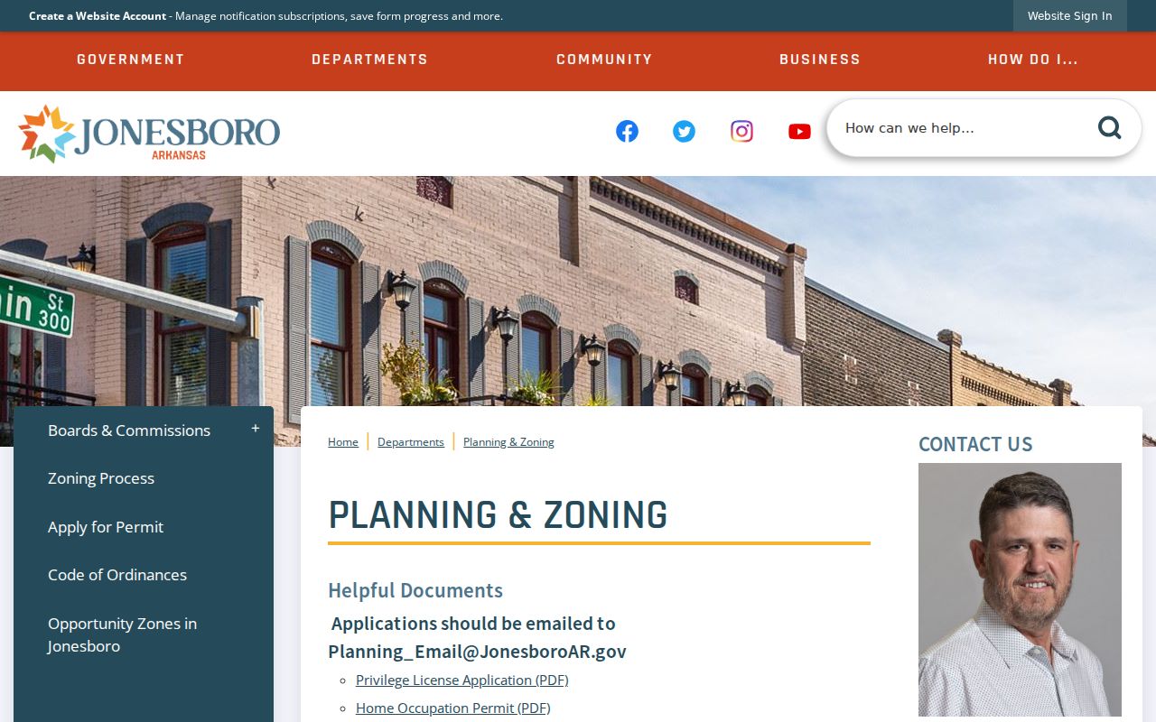
The captured page shows why postal geography should be followed by land records. A planning application may name an applicant or entity and a site, but it does not prove residence. When no public historical permit index exists, ask for an identifiable file by address, record type, and date range.
Special Jonesboro ZIP Records
Two Jonesboro codes need special care. Code 72403 serves post office boxes. It cannot be drawn as a residential neighborhood, and a box number does not identify a physical parcel. Code 72402 is described as unique or organization-associated. It likewise should not be converted into a residential district without verifying the actual mailpiece or address through USPS.
These codes expose a basic limit of a ZIP code directory. Postal codes route mail. A PO box may belong to a person, trust, firm, or other recipient, while a unique code can serve a large organization. Neither supplies city limits, tax jurisdiction, school assignment, election district, or street occupancy. When a record gives only a box or organization code, seek another lawful source with a situs or legal description.
- ZIP
- A USPS routing code for delivery areas or special mail operations, not a municipal border.
- ZIP+4
- The base code plus four digits that narrow a delivery segment, building, box group, or route.
- PO-box ZIP
- A code assigned to post office box delivery rather than a street neighborhood.
- Unique ZIP
- A code assigned for a high-volume organization or other special postal use.
- Carrier route
- A postal delivery sequence within a broader code, not a parcel or voting district.
Verify a Jonesboro ZIP
Use the USPS city and state lookup to confirm which codes USPS currently associates with Jonesboro. For one property, switch to the address lookup and enter the complete street address. Preserve the standardized result as a postal fact with the lookup date. Do not use it as proof of the owner, parcel, city boundary, or district.
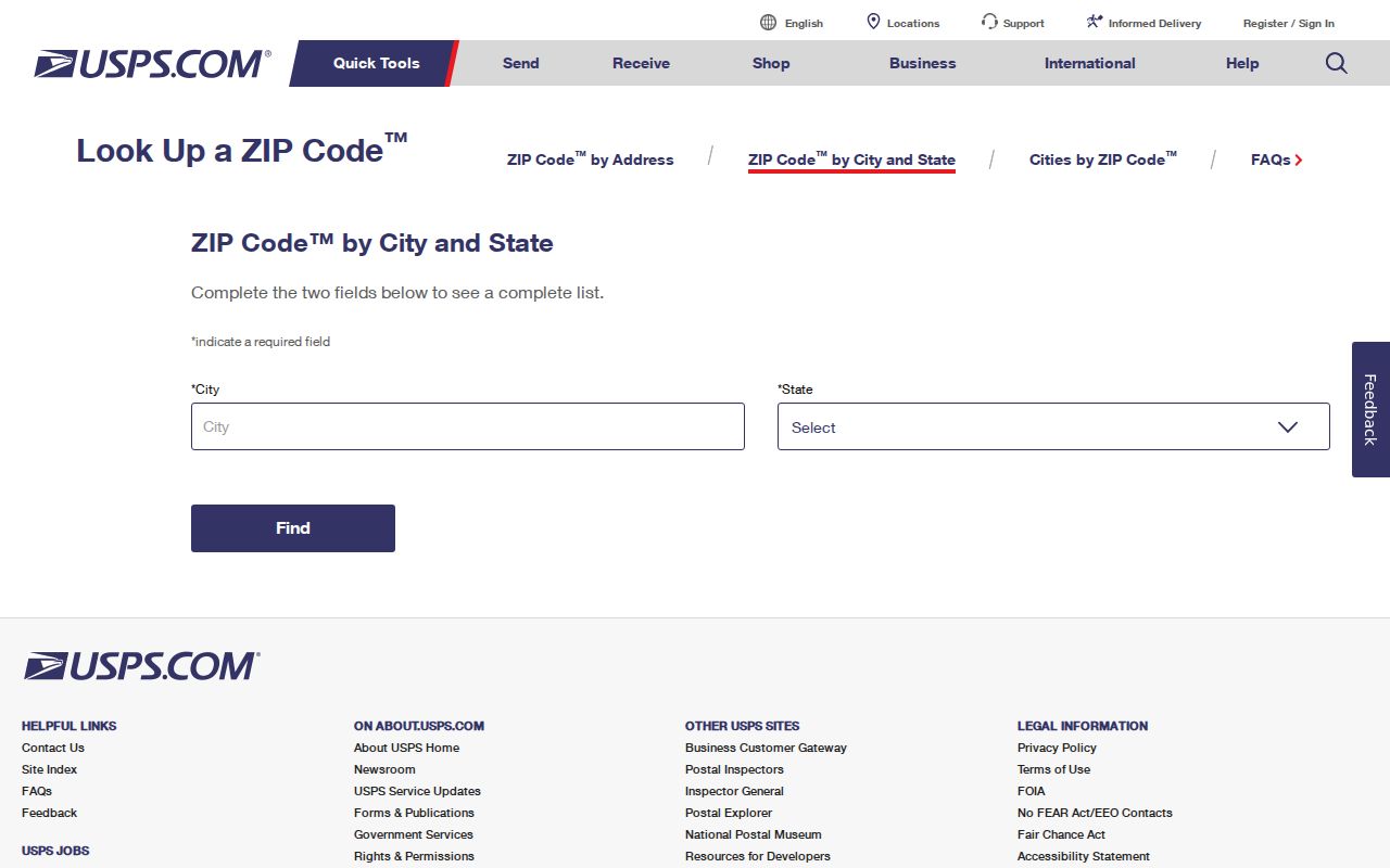
The USPS screen is the strongest first stop for current mail formatting. If a search fails, check spelling, directionals, unit data, and whether the address uses another preferred mailing city. Then move to the parcel map or local addressing authority rather than guessing a code.
- Confirm the full delivery address with USPS and record the standardized city, state, and postal result.
- Search the situs in the Craighead County parcel system, keeping the owner's mailing code separate.
- Open the Jonesboro/Craighead GIS and check the city-limit boundary, parcel, and street centerline.
- Use the correct district or records office for the next fact, such as a deed, plat, permit, or election district.
Find Jonesboro Residents by ZIP
The local portals do not publish a clean ZIP-wide resident search. DataScout parcel cards contain an owner mailing ZIP and a situs address, but the public Craighead profile does not document a ZIP filter. VoterView asks an individual for identifying information and a county; it is not a ZIP-wide browser. The city and county GIS supports geographic map browsing, yet the reviewed page does not promise a postal boundary layer or resident export.
A defensible ZIP code directory workflow therefore narrows gradually. Verify one postal address through USPS. Find that situs in the Assessor roll. Use GIS to understand the parcel and city line. If lawful voter data is needed, use the separate Secretary of State written-request channel and its current terms; restricted fields and protected addresses remain excluded. Once the work reaches a named road, the Jonesboro street directory explains the parcel-by-parcel chain.
Search limit. A no-result in a ZIP field is weak evidence when the portal does not document that filter or the record uses a mailing address.
Jonesboro ZIP and District Lines
Election geography is not postal geography. Craighead County directs residents to VoterView and its address-to-district map. The map accepts a full address, and users can zoom, drag, or click the map when geocoding fails. Its result can identify election districts for that point. It does not convert the postal area into one precinct, and VoterView remains an individual registration check rather than a resident list.
The Craighead County elections page provides the county's address and district route.
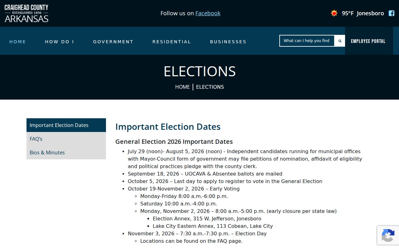
The image connects a full Jonesboro address to official election tools without implying that all addresses in the same postal area share one district. A current district result should retain its retrieval date because election lines and voting locations can change.
Tax and school geography also varies within postal Jonesboro. DataScout lists rural and "JB" millage variants for Valley View, Brookland, and Nettleton, among others. Those paired codes are direct evidence that a common mailing city or school name does not settle municipal tax status.
Jonesboro ZIP Versus City Limits
USPS assigns a preferred mailing city to route mail. That label is not a legal incorporation finding. A parcel with Jonesboro in its mail address may sit outside the city boundary. Another community name may also appear on land in or near an annexed area. The working source for present municipal status is the city-limit dataset in the Jonesboro/Craighead County GIS, paired with the parcel's tax district.
For a historic boundary date, request an annexation ordinance or plat from the City Clerk or Planning. Do not infer the year from a change in ZIP, a new subdivision, or a mail label. E911 addressing, school zones, utility districts, and election districts each answer different service questions. A legal description and recorded plat provide continuity when the postal form changes.
Note: The GIS city line supports municipal status, while USPS supports delivery; neither source should be made to answer the other's question.
Jonesboro ZIP Directory Limits
A ZIP-based result is a search lead, not proof of residence. Parcel records describe owners and tax mail. Planning records describe applicants and projects. Voter products cover registered eligible voters under their access rules. Post office boxes and unique codes may not point to a street at all. Protected addresses remain outside public products, and a nonmatch can reflect spelling, record timing, or an offline source.
Keep an evidence ladder. Current official records with stable identifiers are strongest for the fact they state. Two independent records that agree on name, address, role, and time carry more weight than a postal match alone. Mailing addresses, registered-agent addresses, and contractor addresses show an affiliation, not a household. If a result matters for family history, an heir trail, a property question, or civic research, confirm it with the office that created the record.
Lawful use. Use Jonesboro postal and public records for lawful personal research. Never use them to stalk, harass, threaten, trespass, or uncover a protected address.